The NISAR (NASA-ISRO Synthetic Aperture Radar) satellite is a groundbreaking collaboration between NASA and the Indian Space Research Organisation (ISRO), launched on July 30, 2025, from the Satish Dhawan Space Centre in Sriharikota, India. This Earth observation satellite is the first to use dual-frequency radar (L-band and S-band) to map Earth’s surface with unprecedented detail, offering a new era of environmental monitoring and disaster preparedness.
What is the NISAR Satellite?
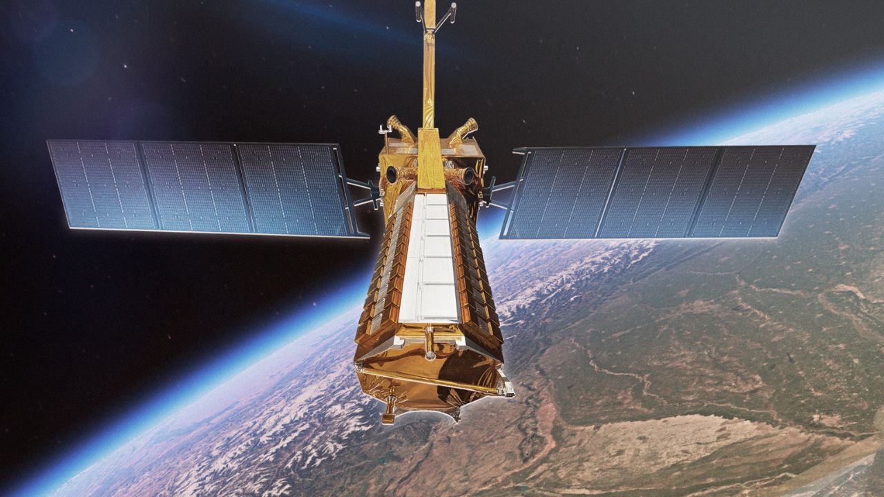
NISAR is a Low Earth Orbit (LEO) observatory designed to monitor Earth’s changing ecosystems, ice masses, and land surfaces. Weighing 2,392 kg, it uses a 12-meter unfurlable mesh antenna and SweepSAR technology to capture high-resolution images, even through clouds and darkness. Launched via ISRO’s GSLV-F16 rocket, NISAR orbits at 743 km in a Sun-synchronous orbit, scanning the globe every 12 days.
Why is NISAR Important?
NISAR’s advanced radar technology makes it a game-changer for science and society. Its L-band (24 cm wavelength) and S-band (12 cm wavelength) radars, provided by NASA and ISRO respectively, allow it to:
- Track Surface Changes: Detect movements as small as a centimeter, like earthquake faults or glacier shifts.
- Monitor Ecosystems: Observe forests, wetlands, and farmlands to support sustainable resource management.
- Aid Disaster Management: Provide rapid data for earthquakes, tsunamis, landslides, and volcanic eruptions, enabling faster response times.
- Study Climate Change: Measure sea level rise, ice sheet changes, and groundwater levels to understand Earth’s changing climate.
All NISAR data is freely available within 1-2 days of observation (or hours for emergencies), promoting global transparency and collaboration.
Key Features of NISAR
- Dual-Frequency Radar: Combines NASA’s L-band and ISRO’s S-band for detailed imaging of land, ice, and vegetation.
- High-Resolution Imaging: Achieves 5-10 meter resolution with a 242 km swath, covering nearly all Earth’s land and ice surfaces twice every 12 days.
- All-Weather Capability: Penetrates clouds and operates day or night, unlike optical satellites.
- Powerful Components: Includes a gold-plated mesh antenna, GPS receivers, a solid-state recorder, and a high-rate communication subsystem for scientific data.
- International Collaboration: Marks the first time NASA and ISRO have jointly developed hardware for an Earth-observing mission.
NISAR’s Journey and Launch
- Development: Initiated under a 2014 agreement, with NASA providing the L-band radar and key subsystems, and ISRO contributing the S-band radar, spacecraft bus, and GSLV Mark II launch vehicle.
- Integration and Testing: Fully integrated by January 2024, the satellite underwent final tests in Bengaluru before being transported to Sriharikota in May 2025.
- Launch: Successfully launched on July 30, 2025, at 12:40 UTC, achieving a precise orbit.
Applications of NISAR Data
- Disaster Preparedness: Tracks seismic activity and landslides, especially in high-risk areas like the Himalayas, to identify earthquake-prone zones.
- Agriculture and Food Security: Provides data on crop growth, soil moisture, and land-use changes to improve farming practices.
- Infrastructure Monitoring: Detects oil spills, urbanization, and infrastructure stability for better urban planning.
- Climate Research: Monitors glaciers, sea ice, and carbon storage to study climate change impacts.
Why NISAR Stands Out
With a total cost of US$1.5 billion, NISAR is likely the world’s most expensive Earth-imaging satellite. Its ability to measure surface changes with centimeter-level precision and its global coverage make it a vital tool for scientists, policymakers, and disaster responders. The mission’s 5-year planned lifespan ensures consistent data for understanding Earth’s dynamic processes.
India’s Role in NISAR
ISRO’s contributions include the S-band radar, spacecraft bus, and launch services, with the U R Rao Satellite Centre in Bengaluru and the Space Applications Centre in Ahmedabad leading the effort. The National Centre of Geodesy at IIT-Kanpur and IIT-Patna supports calibration with corner reflectors. This collaboration highlights India’s growing role in global space exploration.
The Future of Earth Observation
NISAR is set to transform how we monitor our planet. From predicting natural hazards to supporting sustainable agriculture, its data will empower communities worldwide. As ISRO Chairman Dr. S. Somanath noted, NISAR’s ability to study tectonic plate movements could even help predict earthquakes, making it a critical tool for disaster-prone regions.
FAQ:
When and where was the NISAR satellite launched?
The NISAR satellite was successfully launched on July 30, 2025, at 5:40 p.m. IST (12:40 UTC) from the Satish Dhawan Space Centre in Sriharikota, Andhra Pradesh, India, using ISRO’s Geosynchronous Satellite Launch Vehicle (GSLV-F16). The rocket precisely injected the 2,392-kg satellite into a 743-km Sun-synchronous orbit 18 minutes after liftoff, marking a historic milestone in NASA-ISRO collaboration.
Also See: China’s Mega-Dam on Brahmaputra: Impact on Arunachal Pradesh and Assam
Also See: Top Indian CEOs Leading Global Companies in 2025